You are here: OGC Public Wiki>MetOceanDWG Web>MetOcWMSBPMinutes>MetOceanWMSBP20120206 (09 Feb 2012, MarieFrancoiseVoidrotMartinez)Edit Attach
Minutes for the MetOcean DWG Teleconference on 6 February 2012, 16:00 - 17.00 UTC
Attendees:
Jeff de la Beaujardière (NOAA) Matthias Mueller (University of Dresden) Marie-Françoise Voidrot (Météo-France)Status of the works :
Update of the Vertical CRS needs to define Met Ocean products : We have added Geopotential height as a vertical CRS. Wikipedia provides a good definition : http://en.wikipedia.org/wiki/Geopotential_height We will not cover some of the vertical CRS which will probably be necessary for WCS BP but not for WMS BP. The use cases not covered into MO WMS BP will be explicited. The updated schema at the beginning of the teleconf is :
Discussions on vertical CRSs :
Marie-Francoise had good feedbacks from Peter Baumann, chair of Coverages DWG, confirming that our works overlap in a very interesting way with theirs. During the last teleconf Jeff suggested a more flexible way : to provide In WMS Capabilities XML:<Dimension name="computed_surface">0.7PVU, 1.5PVU, 2.0PVU, Tropopause, MSL, Jet_level, ISO_T0, 2nd_Iso_T0, etc</Dimension>
GetMap DIM_computed_surface=Tropopause Each specific surface shall have (mandatory) a standard name (resolvable URI or persistent URL) for each level of interest. For instance the Jet Level is the surface that follows the Jet. Each name shall (mandatory) have a definition (which can be retrieved under that same URL) each model output must conform to that definition (whether pre-defined or generated by the model itself) For instance the METEOTERM database on the WMO Web site provides a definition for the Jet Stream (but not resolvable with a URL at the moment ): "JET STREAM : RELIABILITY : Confirmed
DEFINITION : Flat tubular, quasi-horizontal, current of air generally near the tropopause, whose axis is along a line of maximum speed and which is characterized by great speeds and strong vertical and horizontal wind shears.
DEFINITION SOURCE : International Meteorological Vocabulary, WMO - No. 182 " Users might wish to know about the shape of the computed_surface (the "height field" for a specific model output) (optional). Marie Francoise will check if the current production set provides this type of data for each sample dimension. It is probably often the case (Flight Levels are provided for the Jet LEvel for instance) : It would be surprising to have to change the production at this stage. Using the dimensions "elevation" and another vertical dimension (e.g. computed_surface) might cause problems because it allows illegal combinations in a request ("give me wind_speed at jetstream level at 1000 meters height"). : the client should not build a request with en ELEVATION and a DIM_computed_surface into the same request A proposal of listing explicitly all the levels available mixing the real CRSs and the Sample Dimensions like <Dimension name="LEVEL">0.7PVU, 1.5PVU, 2.0PVU, Tropopause, MSL, Jet_level, ISO_T0, 2nd_Iso_T0, 1000 hPa, 950 hPa, 900 hPa, 850 hPa, ... , 2 M, 10 M, ...etc</Dimension> is discussed but rejected. It would allow to describe a production set but would not allow to implement a nearest value option if the client requests a level which is not exactly one of those available. A solution could be to provide different layers on different services endpointsTwo possible solutions:
1) Demand layers to have either "elevation" or "computed surface" as the vertical dimension. If the information has to be provided for vertical "concepts", separate layers or separate service endpoints shall be used. . (different GetCapabilities)
2) Introduce additional conventions in the WMS protocol that client and service provides have to obey in order to prevent illegal requests. (Error-prone, might provoke further issues with default values etc.)
Actions:
The concept of Sample dimension should be defined Each specific surface should be defined as an abstract entity (Jet Level, 1.5 PVU...) Marie-Francoise will detail the present production from Meteo-France as an example for each Sample Dimension to support discussions.Pending questions :
Could Oceanographers confirm if we should add a "density CRSs" analoguous to pressure levels ?Next teleconf :
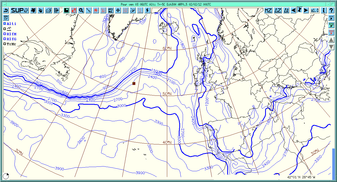
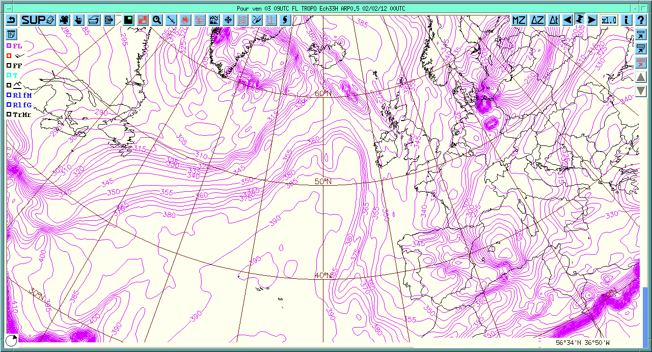
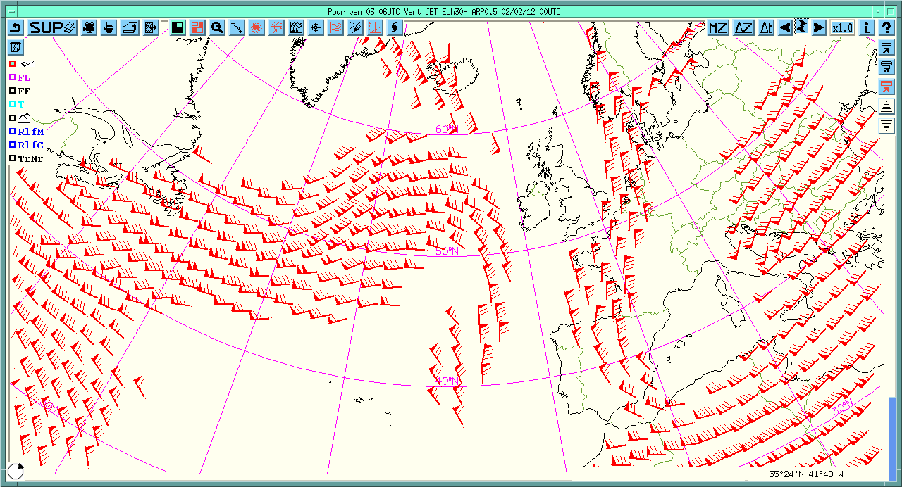
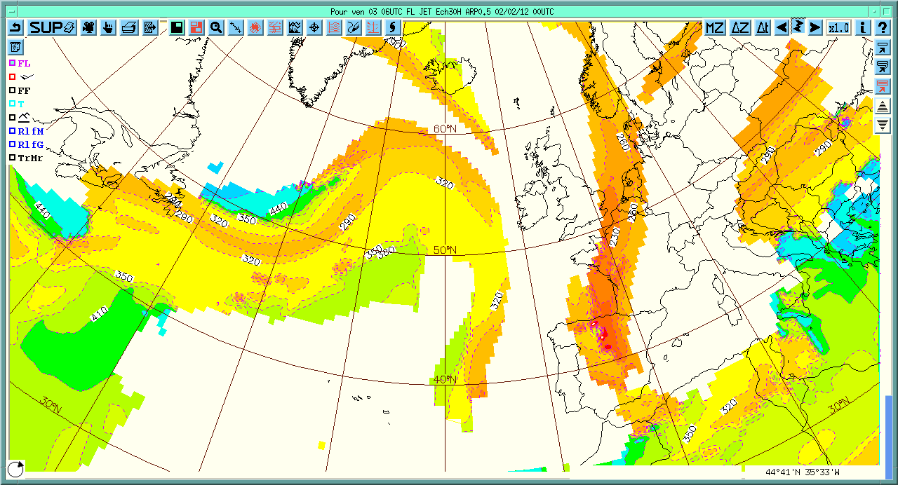
13 February 2012 : 16 UTC Telecon 1 24x7 EST - +1 512 225 3650 passcode:784819#Example of products over sample dimensions provided by Meteo-France:


 -- MarieFrancoiseVoidrotMartinez - 06 Feb 2012
 | I | Attachment | Action | Size | Date | Who | Comment |
|---|---|---|---|---|---|---|
| |
Altitude_At_T-5.gif | manage | 55 K | 06 Feb 2012 - 15:48 | MarieFrancoiseVoidrotMartinez | Altitude at Level Temperature -5 C |
| |
Altitude_at_IsoZR.ps | manage | 358 K | 06 Feb 2012 - 15:47 | MarieFrancoiseVoidrotMartinez | Altitude at Level ISO 0 |
| |
FLWindforce_at_Jet.ps | manage | 5 MB | 06 Feb 2012 - 15:49 | MarieFrancoiseVoidrotMartinez | Flight Level and Wind Force at Level of the Jet |
| |
FLWinds_at_Jet.ps | manage | 5 MB | 06 Feb 2012 - 15:50 | MarieFrancoiseVoidrotMartinez | Flight Level and winds at Jet Level |
| |
FL_at_Jet.gif | manage | 73 K | 06 Feb 2012 - 15:57 | MarieFrancoiseVoidrotMartinez | Flight Levels at Jet LEvel |
| |
FL_at_Jet.ps | manage | 846 K | 06 Feb 2012 - 15:51 | MarieFrancoiseVoidrotMartinez | Flight Level at Jet Level |
| |
FL_at_Tropopause.gif | manage | 80 K | 06 Feb 2012 - 15:50 | MarieFrancoiseVoidrotMartinez | Flight Level at Tropopause Level |
| |
Vertical_CRS_draft_06022012_telco_input.png | manage | 96 K | 06 Feb 2012 - 15:46 | MarieFrancoiseVoidrotMartinez | Draft Vertical CRSs needed for Met Ocean DWG at 06 February 2012 |
| |
Winds_at_Jet.gif | manage | 60 K | 06 Feb 2012 - 15:53 | MarieFrancoiseVoidrotMartinez | Winds at Jet Level |
Edit | Attach | Print version | History: r3 < r2 < r1 | Backlinks | View wiki text | Edit wiki text | More topic actions
Topic revision: r3 - 09 Feb 2012, MarieFrancoiseVoidrotMartinez
- Webs
-
 AIP8
AIP8
-
 ASTROdwg
-
 AgricultureSummit
-
 AustraliaNewZealandForum
-
 AviationDWG
-
 BigDataDwg
-
 BusinessValueCommittee
-
 CATdiscuss
-
 CDBswg
-
 CRSdefinitionResolver
-
 CRSdwg
-
 CanadaForum
-
 ChinaForum
-
 CitSciIE
-
 CitizenScienceDWG
-
 ClimateChallenge2009
-
 CoveragesDWG
-
 DiscreteGlobalGridSystemsDWG
-
 EMSpectrumDWG
-
 EMspectrumDWG
-
 ERGuidance
-
 EUforum
-
 EarthCube
-
 EnergyUtilitiesDwg
-
 GML
GML
-
 GeoSciMLswg
-
 GeoScienceDWG
-
 GeocodingAdHoc
-
 Geospatial3DMS
-
 HealthDWG
-
 HydrologyDWG
-
 I15swg
-
 ILAFpublic
-
 ISGdwg
-
 Ideas4OGC
-
 JAG
JAG
-
 JSONsubGroup
-
 JapanAssistance
-
 LandAdminDWG
-
 MLSdwg
-
 Main
Main
-
 MarineDWG
-
 MassMarket
-
 MetOceanDWG
-
 NREwg
NREwg
-
 NetCDFu
-
 NordicForum
-
 OGC
OGC
-
 PointCloudDWG
-
 QualityOfService
-
 SWEProCitSci
-
 Sandbox
-
 SmartCitiesDWG
-
 System
-
 TemporalDWG
-
 UKIAP2013
-
 UrbanPlanningDWG
-
 Vocabulary
-
 WCTileServiceSWG
-
 WPS
WPS
-
 WaterML
 The information you supply is used for OGC purposes only. We will never pass your contact details to any third party without your prior consent.
 If you enter content here you are agreeing to the OGC privacy policy.
Copyright &© by the contributing authors. All material on this collaboration platform is the property of the contributing authors.
Ideas, requests, problems regarding OGC Public Wiki? Send feedback


